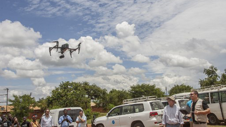

Malawi is making progress in its efforts to stop the spread of cholera and it is all thanks to drones.
Scientists are using drones to identify high-risk areas in the capital, Lilongwe.
The water-borne disease has spread into six districts since the outbreak was first identified in November with at least four people dying and more than 340 cases being reported.
These drones help map areas that are densely populated and collect data for health workers to implement interventions against the spread of the disease.
The drones will provide aerial imagery that will also pinpoint areas that urgently need public awareness campaigns.
The first drone mapping took place in Likuni area, one of the densely populated townships in Lilongwe.
CGTN’s Beryl Ooro has more details.
Cholera is spread by ingesting fecal matter and causes acute watery diarrhoea.
Poor hygiene and the use of contaminated water by residents have been cited as likely causes of the current outbreak.
Community leaders and residents participated in studying the maps and contributed to plans that can help improve things.
Malawi’s drone corridor has been used before for humanitarian operations and development work and as drones become smaller, more reliable and affordable, they are also increasingly being viewed as a component of development and humanitarian assistance.